
[bgmp-map=”105″ center=”okehampton” zoom=”12″ type=”terrain”]
Please reference this interactive map when using the maps below. To see a bigger version of each map below left click the picture.
Hatherleigh Moor.
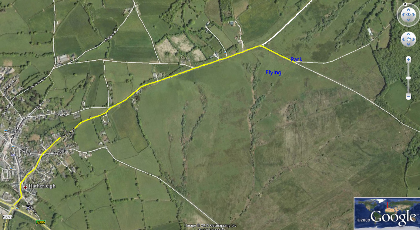
After leaving the round about on the A386 follow the sign for the town. The road curves left. Take the first right and follow this road out of the town. You will then travel along the top of the ridge. When you have passed the monument on the left take the next right. Park in the area around the gate on the left marked. The route is marked in yellow on the above map. Cross the road through the gate to the flying area. Make sure the gate is locked after going through.
Bungalow (also known as St Michael’s Bungalow) Slope Soaring site.
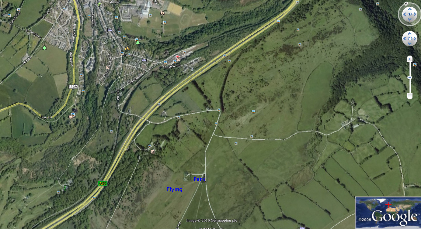
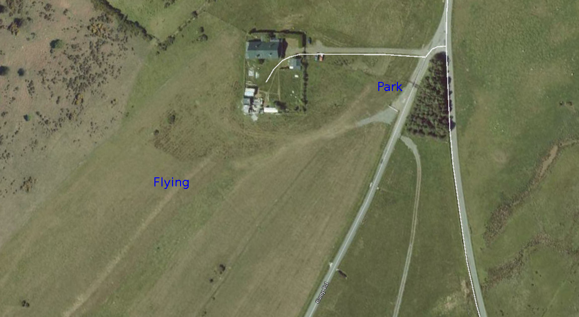
From Fore Street follow the signs for the Camp. At the top of the hill the road forks. Keep right and park on the right before the cattle grid. Enter the field through the gate to the right after the cattle grid and walk up the hill to the slope as shown below. This slope flies WNW to NW
Blackdown Slope site.
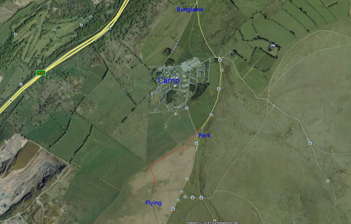
This is situated above the Camp and is only accessible when no live firing is happening as it lies on the edge of the range. At the fork in the road at the Bungalow keep left, turn left at the bottom and after crossing the cattle grid take the road to the right before the bridge. Follow this to a fork and park there as marked. Walk up the hill using the track marked in red. At the top of the hill is a flag pole. Fly out over the valley towards the quarry. This slope flies WNW to NW
Gibbet Hill Slope site
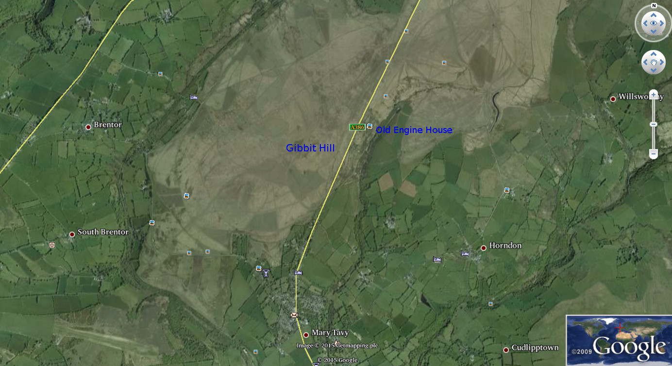
The above map shows the location relative to Mary Tavy and relevant landmarks.
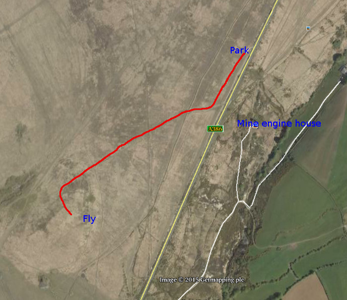
To get to this site take the A386 route to Tavistock from the A30. The route winds through the hills. Eventually the road reaches the top of the ridge where there is a long straight section of road running along the heights. On the left, a deep valley will be visible. When you see the top of the old Engine House stack on the left, look for a small entry to a parking area on the right before reaching the old engine house. Turn into this parking area marked on the map. Go through the small gate and walk along the path shown in red which leads along a gentle rising slope towards Gibbet Hill. Climb the slope. When the path starts to level off leave the path to the left and make your way towards the grassy area over-looking the A386. There is a shallow drop on that face. Launch before the drop, out towards the A386. This slope flies ESE to SE.
Nattadon Common, Chagford.
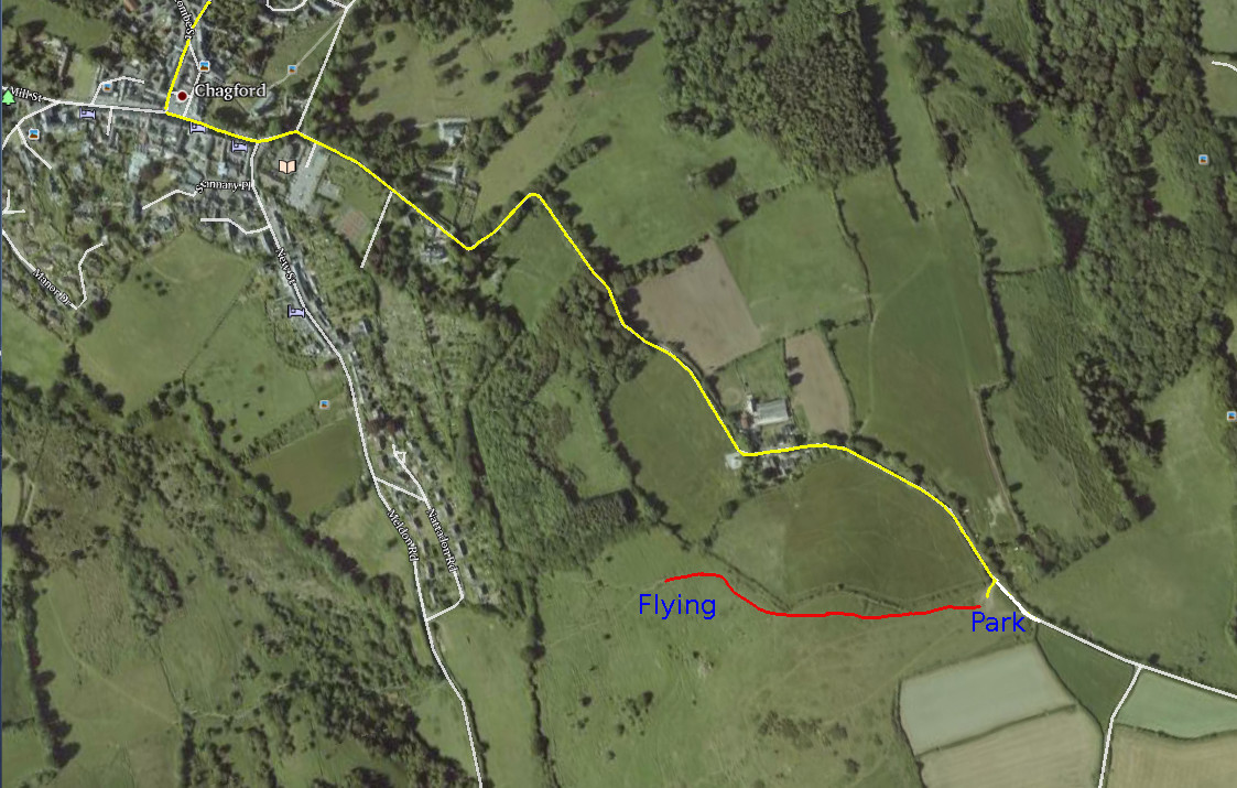
When you have reached the centre of Chagford town turn left and follow the road marked in yellow. You will pass the library and car park on the right and the road will wind up a steep hill. At the top is a cattle grid. Turn right into the parking area a short distance after this cattle grid. Walk up to the slope site using the path marked in red. This slope flies NW.
The flying site map page is superb, thanks Rob.
Nigel